What Maps Imagery Grounding Does
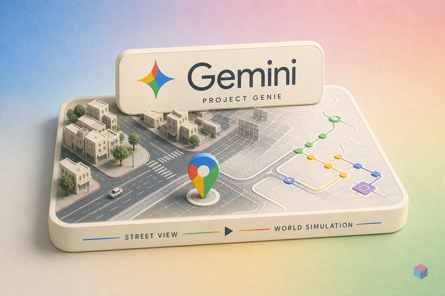
Maps Imagery Grounding is the mechanism by which Genie 3 derives a generated 3D environment's starting geometry from actual Street View photographic data rather than from purely synthetic generation. Announced at Google I/O on May 19, 2026 , the feature gives users a coordinate-selection interface: drop a pin anywhere in the United States on a Maps view, and Genie reads the Street View imagery captured at that location to reconstruct the spatial layout—building setbacks, road widths, intersection geometry—before generating the interactive scene. The resulting environment is not a stylistic approximation of a generic urban or suburban block; it reflects the actual structural layout recorded at that coordinate.
Once a coordinate is selected, four visual style themes are available: Desert Sands, Stone Age, Ocean World, and B&W Film . These are aesthetic transforms applied on top of the real-world geometry—they change surface appearance, lighting mood, and material style without replacing the underlying spatial structure. A Desert Sands scene generated at a dense urban intersection still encodes the actual relationships between buildings, sidewalk widths, and traffic geometry present in the Street View capture. The topology persists beneath the stylization.
An optional character layer lets users describe a playable entity—an animal, a comic book hero, a stylized avatar—that inhabits the generated environment . This is separate from the environment generation itself. The character definition influences the navigating agent within the scene, not the scene construction process. For developers evaluating embodied agent training pipelines, the meaningful layer is the environment geometry; the character definition is a consumer UX affordance.
The output is not a static image, a video clip, or a slideshow of rendered frames. It is an interactive 3D environment the user navigates in real time . That navigability is what separates Genie from prior generative image and video systems and what makes it relevant to robotics simulation pipelines. Generating a plausible-looking image of a street is a solved problem. Generating a traversable, spatially consistent representation of a specific real street is the harder technical problem Genie 3 is attempting to address.
Spatial Memory and Scene Coherence in Genie 3

Spatial memory is Genie 3's most technically significant property relative to earlier generative approaches. When a user rotates their viewpoint inside a Genie-generated environment, the surrounding scene remains consistent—the geometry placed at 180 degrees from the current facing direction is the same geometry that appears when the user turns around. This persistence distinguishes Genie 3 from the frame-by-frame generation paradigm common in video diffusion systems, where each rendered frame is computed independently from a prompt or conditioning signal without reference to a maintained scene state.
"Turn 360 degrees inside a Genie-generated environment, and the AI remembers what was behind you." — Jonathan Herbert, Director at Google Maps (source: The Next Web)
The contrast Herbert is drawing is specific and consequential. Earlier video generation systems regenerate each frame independently. If the user's viewpoint rotates, the generator receives a new conditioning state and produces a new frame—nothing guarantees that the building at the user's original left is still there when they look left again . For a passive video consumer, this inconsistency may be imperceptible or tolerable. For an embodied agent training in that environment, it is a structural problem.
The technical failure mode of frame-by-frame systems is geometric drift: structural elements shift position, disappear, or change configuration between frames as the viewpoint changes. A corridor three meters wide on approach may be two meters wide on return. A doorway present in one frame may not exist in the next. These are not merely visual artifacts—they corrupt the training signal for any agent learning to reason about physical space. An agent that observes a door at position X in one time step and finds no door at position X in the next cannot build a reliable spatial map.
Genie 3 addresses this by maintaining a persistent spatial representation of the scene. Rather than regenerating from scratch on each viewpoint update, the model holds state across movement and rotation . The specific architectural mechanism—whether this is an explicit scene graph, a neural radiance-field-style implicit representation, or a learned memory module—has not been publicly disclosed. What is documented is the behavioral property: viewpoint changes do not trigger full scene regeneration.
For embodied AI training, this property is a baseline requirement rather than a premium feature. An agent learning navigation must experience a spatially consistent environment across time steps. Without that consistency, the reward signal for actions like "move toward the door" becomes unreliable—the door's existence and position cannot be assumed to persist. Genie 3's spatial memory is what makes generated environments viable as training substrates rather than just visually compelling consumer experiences.
The 280-Billion-Image Corpus: Street View as Simulation Substrate
The geometric seed for every Genie-generated real-world environment is Street View's image corpus: 280 billion images collected across 110 countries and all seven continents over approximately 20 years of continuous capture . At the scale relevant to Genie 3's grounding function, this corpus is not primarily a photographic archive—it is a structured geometric dataset. Each image is geotagged and calibrated, meaning the coordinate, heading, and elevation at capture are known. From overlapping multi-angle captures of the same location, spatial structure can be reconstructed: building positions, road widths, sidewalk configurations, intersection shapes.
| Corpus Attribute | Value | Notes |
|---|---|---|
| Total images | 280 billion | Continuously growing; figure as of May 2026 |
| Geographic coverage | 110 countries, 7 continents | Genie grounding restricted to US at launch |
| Collection duration | ~20 years | First Street View vehicles deployed 2007 |
| Vehicle-mounted capture | Road-accessible public spaces | Primary collection mode; covers urban and highway grids |
| Backpack-mounted capture | Pedestrian-only spaces | Adds plazas, trails, and access-restricted roads |
| Temporal currency | Varies by location | Dense urban areas update frequently; some rural captures are years old |
The hardware diversity in the corpus matters for simulation breadth. Vehicle-mounted rigs provide the density and consistency needed for road network reconstruction: multiple passes at known speeds, calibrated camera arrays, overlap sufficient for stereo reconstruction. Backpack-mounted cameras extend coverage to pedestrian-only spaces—plazas, parks, market areas—adding structural variety that driving data alone cannot provide . For robotics teams interested in training agents that operate in mixed vehicle-pedestrian environments, the backpack-captured portions of the corpus are particularly relevant as grounding material.
The key distinction from procedurally generated simulation environments is geometric specificity. When a procedural generator builds a city block for a training simulation, it populates a layout using statistical rules—building heights drawn from a distribution, road widths set by a parameter, intersection geometry selected from a library of templates. The result looks plausible but is not any specific place. Genie's Street View grounding uses actual building footprints, measured road widths, and documented intersection configurations. A generated environment seeded at a real intersection encodes the actual geometry of that intersection, not a statistically typical approximation of one.
Temporal drift is an unresolved concern. Street View imagery ages, and the currency of captures varies significantly by location. Dense urban areas in major US cities may have captures from within the past 12 to 24 months . Less-trafficked areas may rely on captures that are several years old. Buildings change, roads are reconfigured, and construction alters layouts. How Genie handles the discrepancy between its image-derived geometry and current physical reality is not yet documented. For training applications where geometric fidelity to current real-world conditions matters—autonomous vehicle deployment in a specific city, for instance—the capture date of the underlying Street View imagery is a variable that teams will need to account for explicitly.
Waymo's Rare-Scenario Training: How Genie Powers the Simulation Loop

Genie 3 already supplies one of Waymo's active simulation environments for robotaxi training . This is operational use, not a proof-of-concept or a roadmap item. The specific training problem Genie addresses for Waymo is rare-scenario coverage: generating training examples for events that are either too dangerous to reproduce intentionally in real-world testing or too statistically infrequent to accumulate at the scale needed for robust model training. Documented examples include tornadoes and unexpected wildlife encounters on roads .
| Scenario Category | Real-World Collection Feasibility | Genie's Role | Geometry Basis |
|---|---|---|---|
| Tornado / severe weather | Impractical and dangerous to reproduce intentionally | Synthesize event within a real road network environment | Actual intersection / road geometry from Street View |
| Unexpected wildlife on road | Statistically rare; cannot be staged safely at scale | Generate encounter scenarios across diverse real locations | Real road width, curvature, and sightline geometry |
| Common urban driving | Abundant; real-world fleet sensor logs available | Not primary Genie use case; covered by existing data | N/A — not a Genie gap-fill target |
| Unusual pedestrian behavior | Edge cases difficult to capture at training scale | Potential future scenario type; not yet confirmed | Street View sidewalk and crosswalk geometry |
The structural significance of grounding rare scenarios in real geometry is that it preserves the sim-to-real relevance of the training data. If a tornado scenario plays out on an invented road network with generic intersection geometry, the trained model learns to handle the event abstracted from real-world road configurations. If that same scenario plays out on the actual layout of a Phoenix or Pittsburgh intersection, the trained behavior is calibrated to the specific turning radii, signal positions, and lane configurations the deployed vehicle will actually encounter . The geometry is not scenery—it is a training variable.
Sim-to-real transfer quality correlates with Street View capture density. Dense urban grids with frequent multi-angle passes—San Francisco, Phoenix, and Austin, where Waymo operates—offer more complete geometric reconstruction and therefore more accurate scene seeding. Sparse rural corridors with single-pass, lower-resolution captures offer less. This creates a geographic tier structure for training benefit: Genie-grounded scenarios are most valuable in exactly the dense urban environments where autonomous vehicle deployment is most active, and less valuable where Street View data is thinner.
The mechanism by which Waymo accesses Genie 3 is not publicly specified. Given that no developer API exists for the feature, Waymo's integration almost certainly operates through a private partnership arrangement with Google rather than through any interface available to external teams . This distinction matters for teams evaluating the Waymo use case as a model for their own robotics pipelines: the capability is real and operational in at least one production context, but it is not currently replicable through any publicly available tooling.
Embodied AI Training: Why Real Geometry Matters
The core argument for real-geometry-grounded simulation is transfer efficiency. Training environments built from actual spatial layouts reduce the distribution gap between simulation and deployment, which is a primary driver of sim-to-real failure in robotics. An agent trained on environments derived from actual building footprints, measured door placements, and documented stairwell configurations encounters fewer geometric surprises when deployed in real spaces. The gap is not eliminated—Google acknowledges that current generation quality resembles video game graphics rather than photorealistic capture—but it is narrower than the gap produced by procedurally authored simulation .
Manual authoring of synthetic training environments is a meaningful engineering bottleneck. Creating a diverse set of outdoor environments for navigation training—varied intersection types, road geometries, sidewalk configurations—requires modeling work that scales poorly. Each new scene type requires authoring effort proportional to its structural complexity. Street View grounding automates the seed geometry for outdoor environments without that overhead. The coordinate picker is effectively the authoring interface; the structural diversity of 280 billion images across two decades of capture becomes available as training input without additional modeling investment .
The rare-event synthesis pattern Waymo demonstrates is generalizable. Any robotics team that needs low-frequency scenario coverage—manufacturing floor incidents, emergency response maneuvers, unusual pedestrian behavior patterns—can apply the same approach: seed the environment with real geometry, generate the rare event within that geometrically verified context. The training data inherits both the statistical rarity of the event and the geometric specificity of the space. That combination is difficult to achieve with purely synthetic authoring (which can add rare events but lacks geometric specificity) or purely real-world data collection (which cannot stage rare events at scale).
Coverage gaps are significant and should be planned around now. The current grounding capability is bounded by what Street View has captured: outdoor, street-level, vehicle- or backpack-accessible public spaces. Interior spaces—warehouses, offices, hospitals, retail floors—are absent. Underground transit environments are absent. Non-road-accessible structures and private land are absent. For teams building agents that operate in any of these environments, Genie's Street View grounding is not a substitute for purpose-built simulation; it addresses the outdoor street-level problem specifically .
Geographic Scope and Current Constraints
Street View grounding in Project Genie launched on May 19, 2026 as a US-only feature . International expansion is described as planned, but no schedule has been announced. Given that Street View itself covers 110 countries, the geographic restriction is a launch-phase constraint rather than a permanent architectural limitation—the underlying data exists—but the timeline for when non-US location grounding becomes available is unspecified. Teams planning training pipelines that require non-US geographic coverage should assume US-only access for the near-term planning horizon.
Access is gated behind Google AI Ultra at $200 per month . No lower-tier pricing option has been announced, no free trial specific to this capability exists, and no enterprise or research tier is available as of the May 2026 launch. For individual researchers or small teams evaluating the capability, $200 per month provides technically feasible access. For organizations thinking about scaled production use—the kind implied by Waymo's integration—the consumer subscription tier is almost certainly not the intended long-term delivery mechanism, though no alternative has been announced.
Rollout is phased to eligible US subscribers aged 18 and older, beginning May 19, 2026, with completion planned over the following weeks . Subscribing to AI Ultra in late May 2026 does not guarantee immediate access; the phased rollout means some subscribers will see the feature before others. Google's stated geographic and age restrictions are the only documented eligibility criteria beyond active Ultra subscription status.
The feature boundary follows the Street View capture boundary: outdoor, street-level, publicly accessible spaces reachable by vehicle-mounted or backpack-mounted cameras . Indoor environments, aerial perspectives, and areas not covered by Street View are outside the announced scope. This is not merely a content policy constraint—it is a data dependency. Genie's grounding mechanism works by drawing on captured imagery; where no imagery exists, grounding cannot function. The constraint is structural rather than provisional.
What Technical Teams Cannot Do Yet

No public API or SDK for Project Genie has been announced as of May 2026 . Access is exclusively through Google's consumer web interface for AI Ultra subscribers. There is no programmatic way to request environment generation for a set of coordinates, set scene parameters, iterate over multiple locations, or retrieve any form of scene data. Genie is a Google Labs experiment accessible through a browser—not an engineering service with a defined interface.
The absence of an API means that several workflows technical teams might plan around Genie are not currently possible:
- Batch generation: Programmatically generate training environments across a set of target coordinates. Not supported.
- Scripted parameterization: Specify scene parameters—style theme, lighting, agent definition—via API call. Not supported.
- Scene geometry export: Extract generated scene geometry in a format importable to external simulation engines such as NVIDIA Isaac Sim, Gazebo, or CARLA. Not supported.
- Scenario replay: Load a previously generated environment at a known state for reproducible training runs. Not supported.
- Automated evaluation loops: Connect a simulated agent to a Genie environment and run scripted evaluation passes. Not supported.
Waymo's operational use of Genie 3 does not change this picture for external teams. Waymo's access almost certainly operates through a private arrangement with Google rather than through any interface that external organizations can replicate . The existence of an operational Waymo integration confirms that the underlying technical capability is real and production-ready in at least one context. It does not imply that equivalent access is available to anyone else.
For teams evaluating simulation tooling now, the practical planning posture is to treat Genie as a capability to track rather than a system to integrate. Monitor Google's developer announcements for API access, SDK releases, or an enterprise tier. The consumer preview establishes what the system can do; the gap between consumer preview and production engineering infrastructure remains wide, and the timeline for closing it has not been stated . Google itself has acknowledged that interactive world generation trails video generation in accuracy by approximately 6 to 12 months—a candid signal that the system is at an early stage of the quality curve.
Frequently Asked Questions
What is Maps Imagery Grounding in Project Genie?
Maps Imagery Grounding is the feature that connects Project Genie's environment generation to real-world spatial data. A user selects any US location using a pin-drop interface on a Maps view; Genie reads the Street View imagery captured at that coordinate and derives the starting geometry of a generated 3D environment from the actual structural layout recorded there—building positions, road widths, intersection configurations—rather than constructing a synthetic approximation. The result is an interactive 3D environment whose spatial structure reflects a real place. Four visual style themes (Desert Sands, Stone Age, Ocean World, and B&W Film) can be applied as aesthetic layers on top of the grounded geometry without altering the underlying spatial structure .
How does Genie 3's spatial memory differ from video generation?
Video generation systems typically recreate each frame independently from a prompt or conditioning signal. When the viewpoint changes, a new frame is generated from the updated conditions—nothing guarantees that structural elements present in the prior frame persist in the new one. This causes geometric drift: buildings shift, doorways disappear, corridor dimensions change between frames. Genie 3 maintains a persistent spatial representation of the scene across viewpoint changes. When a user turns 360 degrees, the geometry behind them when they started is still there when they face that direction again. This property is a prerequisite for using generated environments as embodied AI training substrates—agents learning navigation require spatially consistent environments across time steps to develop reliable spatial reasoning .
How is Waymo using Genie 3 for autonomous vehicle training?
Genie 3 supplies one of Waymo's active simulation environments for robotaxi model training, specifically targeting rare-event scenarios: events too dangerous to reproduce intentionally in real-world testing or too statistically infrequent to collect at training scale through normal fleet operation. Documented examples include tornadoes and unexpected wildlife encounters on roads. Critically, these rare events are synthesized within environments whose geometry is derived from actual mapped road networks, not invented layouts. This means trained model behavior is calibrated to real road configurations—actual lane widths, intersection geometries, and sightlines—rather than to generic synthetic approximations. Waymo's access to Genie 3 is presumed to operate through a private arrangement with Google, not through any public interface .
Is there a developer API for Genie's world simulation?
No public API or SDK for Project Genie has been announced as of May 2026. Access is exclusively through Google's consumer web interface for AI Ultra subscribers at $200 per month . There is no programmatic way to request environment generation, set scene parameters, batch-generate environments across coordinates, or export scene geometry to external simulation engines. Waymo's operational use of Genie 3 for training operates through an undisclosed private arrangement—it is not evidence of publicly available API access. Teams evaluating Genie for engineering workflows should treat it as a capability to monitor rather than a system to plan an integration around today.
What real-world locations does Genie's Street View grounding support?
At launch on May 19, 2026 , Street View grounding is limited to locations within the United States. International expansion is described as planned, but no schedule has been announced. Within the US, coverage follows what Street View has actually captured: outdoor, street-level, publicly accessible spaces reachable by vehicle-mounted or backpack-mounted cameras. Indoor environments, aerial perspectives, and areas not covered by Street View are outside the current scope. Rollout began May 19, 2026, with phased access to all eligible US-based AI Ultra subscribers aged 18 and over over the following weeks.
What to Watch For
The Street View grounding announcement establishes a clear technical direction: world simulation anchored in documented physical reality, with maintained spatial coherence enabling embodied agent training, and at least one confirmed operational deployment (Waymo) that validates the approach in production. The constraints are equally clear—US-only geographic scope, consumer-only access at $200 per month, no API, no geometry export, and visual quality Google itself describes as video-game-grade rather than photorealistic. The current state is best understood as a production-validated proof of direction, not a production-ready tool for external engineering teams.
The most significant signal to watch for is API access. The consumer product demonstrates that the underlying technology works at a meaningful fidelity level. The step from "interactive consumer feature" to "engineering infrastructure" requires programmatic access with defined parameters, batch generation, and output portability to external engines like Isaac Sim, Gazebo, or CARLA. None of that exists today. When Google announces a developer tier or research access program, it will change the evaluation calculus substantially for robotics and embodied AI teams .
For teams building simulation infrastructure now, the practical step is a gap analysis against the announced scope. Genie addresses outdoor street-level geometry for US locations. The complementary problems—interior spaces, non-public-access areas, international locations, aerial perspectives—remain open. Teams should identify where Genie's coverage ends and where purpose-built simulation, existing public datasets (Matterport, ScanNet, nuScenes), or direct real-world data collection remains the only viable path. Planning against the announced constraints now avoids the common mistake of designing a pipeline around a capability that cannot yet be integrated.
Last updated: 2026-05-30. Based on Google I/O 2026 announcements and coverage published May 19–20, 2026.